
ETOSHA TRAVEL TIPS
Places of Interest in Etosha: What to See Beyond a Wildlife Checklist
Etosha’s most rewarding places combine wildlife, water, geology, history and distinctive vegetation. The aim is not to race between landmarks, but to use them as anchors for slower, better-planned safari days.
Road conditions, access and wildlife change. Confirm current information locally and allow enough time to stop when the landscape becomes the main attraction.
BUILD THE DAY AROUND LANDSCAPES
Use places of interest as route anchors, not a race itinerary
A named place is most useful when it helps you choose habitat, timing and a realistic loop. Leave room for the unplanned sighting between destinations.
PURPOSE
Choose one main theme for the drive
A waterhole-focused morning, pan-edge route or landscape afternoon creates a clearer plan than trying to include every label on the map.
DISTANCE
Judge routes by time, not kilometres alone
Wildlife stops, gravel roads and congestion can turn a short distance into a long experience. Keep the return conservative.
SEASON
Expect the same place to look different
Rain, dust, water availability and vegetation transform views and animal movement. A quiet stop in one season may be productive in another.
PATIENCE
Allow the place to develop
Stop, scan and listen before deciding that nothing is happening. Many locations reveal their value slowly.
THE ETOSHA PAN & OPEN LANDSCAPES
Read scale, light and distance as part of the safari
The pan and its surrounding plains give Etosha its visual identity. Even when wildlife is distant, these open environments explain movement, weather and the park’s extraordinary sense of space.
PAN EDGE
Use the boundary between surfaces
Where open pan, grass and woodland meet, changing habitat can concentrate movement and create long sight lines.
VIEWPOINTS
Stop only where access is clearly permitted
Use designated lookouts and authorised roads. Do not leave the vehicle or cross barriers for a cleaner photograph.
MIRAGE
Expect distance to deceive the eye
Heat shimmer can make animals and features difficult to judge. Binoculars help separate real movement from optical effects.
LIGHT
Plan for glare and hard contrast
The pale surface reflects intense light. Sunglasses, exposure checks and early or late viewing can improve comfort and photography.
WEATHER
Watch the horizon
Storms, dust and cloud can reshape the landscape rapidly. Keep the route flexible and avoid exposed areas when conditions become unsafe.
CONTEXT
Photograph the scale, not only the animal
Wide frames reveal why wildlife behaves differently in open country and create images distinct from close portraits.
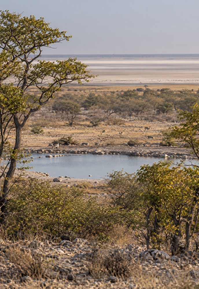
WATERHOLES
Let water guide observation without controlling the entire route
Waterholes are among Etosha’s best-known destinations, especially as seasonal water disappears. Each stop still requires patience, ethical positioning and realistic expectations.
ARRIVAL
Approach slowly
Animals may be beside the road or hidden behind parked vehicles. Reduce speed before the final approach.
SCAN
Look beyond the water’s edge
Check shade, access paths, open ground and the reactions of animals already present.
WAIT
Give an apparently quiet stop time to change
Arriving herds, birds and predators can transform the scene within minutes.
POSITION
Keep approaches and roads open
Do not block an animal’s path to water or form a wall of vehicles.
SEASON
Expect changing reliability and use
Water levels and animal concentrations vary. Ask for current local observations instead of relying on a permanent species list.
MOVE ON
Leave when pressure or congestion builds
A different habitat may offer a better experience than joining an overcrowded stop.
CAMPS & FLOODLIT WATERHOLES
Use camp-based viewing as part of the daily rhythm
Rest camps are more than overnight stops. Their facilities, interpretation and nearby viewing can create valuable pauses between longer drives.
OKAUKUEJO
Combine western and central routes with camp viewing
The camp is a practical base for nearby plains, waterholes and evening observation when current facilities allow.
HALALI
Use the central position to divide long routes
Halali can support loops in several directions and offers a useful midday reset between habitats.
NAMUTONI
Explore eastern woodland and pan-edge country
The eastern area brings different vegetation, birdlife and access choices from the more open west.
EVENING
Let camp viewing replace another rushed drive
A quiet hour at a camp waterhole can be more rewarding than adding distance late in the day.
INFORMATION
Ask staff what changed recently
Road conditions, water activity and closures can change faster than printed advice.
COURTESY
Share camp viewpoints quietly
Keep voices, screens and movement considerate so others can enjoy the setting.
FAIRY TALE FOREST
Visit for unusual vegetation, atmosphere and ecological context
The Moringa ovalifolia trees create one of Etosha’s most distinctive botanical stops. Treat the area as a fragile landscape rather than a roadside prop.
FORM
Look at the trunks and branching structure
The pale, swollen forms and sparse branches create the ‘upside-down’ appearance associated with the forest.
SETTING
Notice how unusual the trees are on the plains
The concentration is striking because the species is often associated with rocky slopes elsewhere in its range.
ELEPHANTS
Read browsing as part of the ecosystem
Elephant feeding can shape individual trees and the wider character of the stand. Observe without leaving authorised areas.
PHOTOGRAPHY
Use light and negative space
Simple compositions, early or late light and careful framing suit the sculptural trees better than crowded snapshots.
BUILDING A PLACES-OF-INTEREST ROUTE
Connect nearby habitats instead of collecting isolated stops
The strongest itinerary links a small number of destinations into a loop with room for waterholes, viewpoints, rest and unexpected wildlife.
MAP
Mark the gate or camp first
Every route should begin with the return point and deadline, not the furthest attraction.
ANCHOR
Choose one must-see place
Make the other stops optional so the day can absorb a long sighting or slow road.
HABITAT
Include contrasting environments
Open plains, woodland, pan edge and water produce more varied observation than repeating one setting.
BREAK
Use designated facilities strategically
A planned stop improves concentration and reduces the temptation to leave the vehicle where it is not permitted.
TURNAROUND
Set a decision time
If the route is running late, remove the furthest optional stop before the schedule becomes unsafe.
RETURN
Avoid retracing solely to chase a report
Wildlife information ages quickly. A sensible return through productive habitat is usually better than a rushed pursuit.
SEASON, LIGHT & PHOTOGRAPHY
Expect the character of every place to change through the year
Dry conditions emphasise dust, open sight lines and water dependence; greener months bring colour, clouds, seasonal birds and dispersed wildlife.
DRY
Use texture and concentration
Pale grass, exposed soil and busy waterholes communicate the pressure of the dry season.
GREEN
Use colour and weather
Fresh growth, reflections and storm light can make familiar places feel completely different.
MORNING
Look for soft light and movement
Cooler conditions can support activity, but cold starts require clothing layers.
MIDDAY
Photograph scale and rest
Hard light can be difficult for portraits, yet useful for landscapes, shade and waterhole behaviour.
AFTERNOON
Work toward the return point
Use warm light only on a route that leaves a safe margin before closing.
DUST & RAIN
Protect equipment before conditions arrive
Keep a closable bag, cleaning supplies and weather protection accessible inside the vehicle.
BEFORE THE DRIVE
Places-of-interest planning checklist
A short preparation keeps a sightseeing route realistic and leaves room for wildlife.
01
Choose one primary destination
Treat every other stop as optional.
02
Confirm roads and facilities
Use current local information.
03
Check the return deadline
Plan a comfortable margin.
04
Carry an offline map
Know the alternatives before signal disappears.
05
Pack water and weather layers
Conditions can change during a long loop.
06
Prepare binoculars and camera
Keep them accessible without loose gear.
07
Use designated stopping places
Never create a viewpoint by leaving the road.
08
Let a good sighting change the plan
Quality matters more than completing the list.
PLACES OF INTEREST FAQ
Answers for planning a more varied Etosha visit
Use these answers to shape the route, then confirm access and conditions locally.
FAQ
How many days do I need for Etosha?
More time allows shorter loops and repeated habitats. The right stay depends on the gates, camps and wider itinerary rather than a universal minimum.
FAQ
Are waterholes the main places of interest?
They are important, but the pan, plains, woodland, camps, viewpoints and unusual vegetation make the park more varied.
FAQ
Can I visit every major place in one day?
Trying to do so usually creates excessive driving. Choose a region and a few flexible anchors.
FAQ
Is Fairy Tale Forest worth a special stop?
It is especially worthwhile for travellers interested in vegetation, landscapes and photography, provided it fits naturally into the route.
FAQ
Where should I stop for photographs?
Use authorised viewpoints, camps and safe roadside positions that keep traffic and animal routes open.
FAQ
Which season is best?
Dry and green periods offer different strengths. Choose between concentrated wildlife, open views, colour, birds and dramatic weather.
FAQ
Can I leave the vehicle at viewpoints?
Only where current rules and signs explicitly allow it. Never infer permission from another visitor.
FAQ
What if a planned road is closed?
Use the closure as a reason to simplify the route. Current signs and staff directions override maps and old advice.
CHOOSE THE REGION, THEN LET THE DAY UNFOLD
Turn Etosha’s places of interest into a realistic safari route
Choose accommodation that places the right landscapes and waterholes within comfortable reach, then keep the daily plan flexible enough for wildlife and changing conditions.